Category Archives: Uncategorized

Kashgar to Tashkorgan with the NY Times

Beijing based NY Time reporter Andrew Jacobs has a good travel article on Kashgar and the road to Tashkorgan (photos like the one above, by Gillies Sabrie, accompany it). Interestingly he describes avoiding handing over passports at the hotel in Urumqi. This can indeed happen at smaller hotels tough is not of course sanctioned. More commonly hotels use scanners that will transmit the passport details straight to the PSB. From experience it also appears that credit card usage can be used to monitor accommodation. A few commenters on the article are confused about Lake Karakul – there is one south of Kashgar as well as one in Tajikistan. It is a fairly common name – Kara, as in Karakorum, is common in Turkic and Persian linked languages and means black, while kul is lake.

Also, Kyrgyz border that is described as being basically shut is very much open with a huge highway heading to it from Kashgar and a rumoured (as of Sept 2013) Chinese SEZ to be formed by an apparently c 50km2 land purchase by some organ of the Chinese state over the border, inside Kyrgyzstan. The only blocked border is with Afghanistan, to the west of Tashkorgan.

If Mr Roberts was to continue south over the Khunjerab pass and into Pakistan it is likely that he would in fact still encounter Attabad Lake near Hunza – latest information appears to indicate it is still in place.

Duke of Bedford’s guide to dressing

From the archives of British educational broadcasting (Pathé), 1959 – how to dress swiftly and neatly; as exemplified by the duke of Bedford shown here with the aid of his mammoth walk in wardrobe. Clearly a compact version needed for overseas travel demands. Gieves have recently done an updated version.

Salve Tartaria

Returning from Shipton’s Arch with just one final night in Kashgar, there was only one activity left to undertake – which was to get changed into desert-issue number 1s and repair back to Chini Bagh for photographs before seeking refreshment.

A final blockade waits for us the next day. The mixture of travel and time differences means that despite a wander around town earlier in the day, we have not realised we are trying to get a cab to the airport in the middle of Friday. The roads are almost literally empty and it comes together that we have seen screeds of men pouring into the town’s various mosques. One chap even stops me to check I know where I’m going, should I be Moslem. The only drivers and women or Han.

It has been just on two weeks across from Dunhuang to Kashgar; certainly the slow and long way. Altogether an overland journey of around 2,000km, allowing for our shortcut across the Kumtagh.

While all parts had proven easier than initially thought – more accessible, more developed – this was impossible to judge from a distance and even now we’re not entirely sure what our status was while travelling quietly across Lop Nur.

The explorer Sven Hedin, who was the heir to the earlier late nineteenth century explorers of this region and spent decades in and out of Central and Inner Asia, wrote a series of books on his experiences in what is now Xinjiang in the 1930s – The Trail of War, The Silk Road and The Wandering Lake. In the latter he writes:

"It had been my dream, as I have said, to revive and open for motor traffic the old Silk Road, abandoned for 1,600 years [since around 330 AD when rivers and lakes changed and towns and routes were left for mor hospitable ones], which had led from China proper via Tun-hwang, Lop Nur, Lou-lan and the Kum-daria to Kashgar."

This is the original heart of the Silk Road and, in many ways thankfully, a full road route has still not been achieved. There are certainly roads that will take you most of this way now – but hopefully the unmarked desert crossing will remain an essential part of it if you want to travel from Dunhuang across Lop to the southern Tarim.

As Hedin writes also in this book: "Then, as now, the fascination of the enterprise lay in the pregnant question, "Will it come off or not?". Unusually for us, this time it seems to have worked. But that just goes to show, it wasn’t quite hard enough.

We’ll have to work on this for next time.

A visit to the famed Shipton’s Arch on the Kyrgyz-Xinjiang border

On our last full day in Kashgar, we arrange to travel towards one of the other main goals of this trip – the little visited Shipton’s Arch.

Eric Shipton was the senior mountaineering figure of his time, who led a number of Everest reconnaissance missions and, with long term partner and fellow intrepid adventurer Bill Tilman developed the idea of trim mountain climbing teams, rather than grand pack-animal borne retinues – thus undemocratically (albeit perhaps unintentionally) ruining climbing for the amateur with an aversion to high intensity fitness regimes.

Tilman himself was a prominent character who fought in both world wars, was the last recorded Westerner to cross the Wakhjir Pass from China into Afghanistan in 1947 and who lost his life, AET 79, on a sailing adventure in the Atlantic in 1977 – the same year as Shipton died.

The trip over the Wakhjir for Tilman came as he was ‘walking home’ to India after a visit to Shipton at Kashgar. Shipton was consul at Kashgar from 1940-42 and then was the final consul for Britain (pre subcontinental independence and partition) 1946-47. In between times he was cereal or agricultural adviser in both Persia and then Hungary. An improbable string of appointments and titles that is a little difficult, superficially, to reconcile to his known skills and interests but presumably gave him wide scope for other activities during wartime.

Xinjiang at the time was immersed in an almost historically impenetrable swirling mess of changing allegiance as armies from the Chinese nationalist government, their notional governor-appointee in Urumqi, Hui (or Tungan) armies from Gansu, Uyghurs and Soviets did battle while constantly changing teams. It seems to be about as close to a game of Risk (between players who know they will not play together again) as one can get.

In addition, from at least the 30s there were rumours that Lawrence of Arabia was waiting just over the Karakorum to the south to swoop in and seize control of the province and prevent it falling to full enemy control the way Mongolia had to Soviets and Manchuria to the Japanese. Fleming and Maillart encountered this rumour, that may have been fuelled by Lawrence, under a pseudonym, actually being posted with the RAF in Peshawar for ‘frontier policing’ i.e. using planes to quell the Pathan tribes via village strafing. Tempora mutantur… Lawrence was swiftly sent back to the UK after word got out and around the local community of his presence but any British designs on Xinjiang would require a rather detailed look through India Office papers.

There may have been some interest. Billy McLean, Special Operations Executive officer who served with distinction in Albania and East Africa, came to Kashgar as military adviser in 1945 – though notionally focussed on Japan rather than the now Soviet allies.

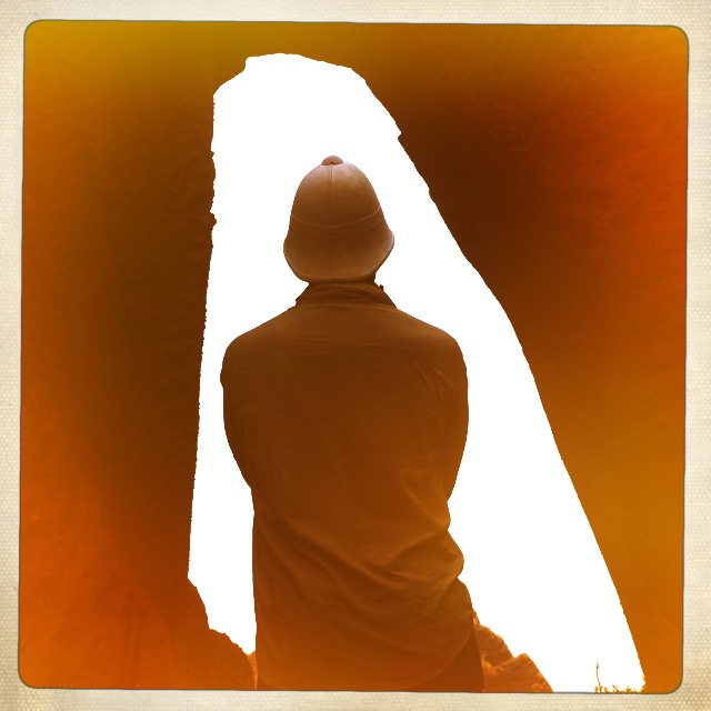
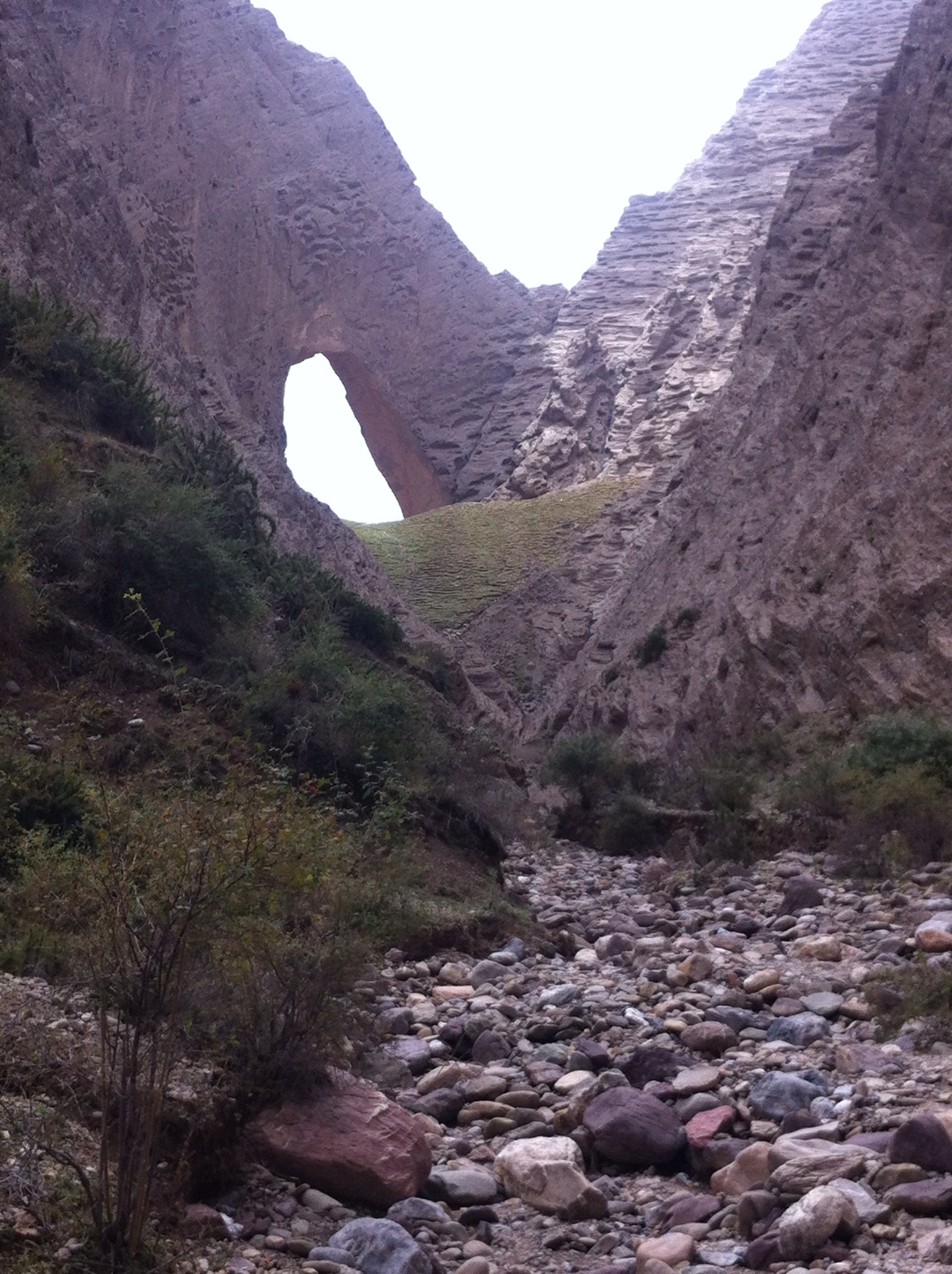
Anyway, back to Shipton. From his writings (Mountains of Tartary etc) about his time in Kashgar it appears his main focussed continued to be alpinism. He and Tilman tried to climb the now very busy Muztagh Ata but did not quite make it. Shipton was however the first outside to discover Shipton’s Arch, in 1947. This is the world’s largest natural formed arch and stands arund 1200 feet clear of the ground on one side – about the height of the Empire State Building – and around 180 feet wide.

Shipton apparently came across it having heard about it from locals. It sits in the very dense and irregular Black Mountains that separate China and Kyrgyzstan. The nearest town is Artush.

We had read, as with the southern Tarim route, that access was difficult and few knew the eact location. Indeed the Arch disappeared from international knowledge altogether following the inital discovery, until 2000 when a National Geographic trip rediscovered it.

Now however an improved autoroute is being built towards the Kyrgyz border. Unlike the borders with Afghanistan and Tajikistan, this is a normalised one with third country traffic, such as tourists, allowed to pass, and China has been making a major economic impact on Kyrgyrzstan that it seems set to consolidate.

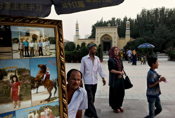
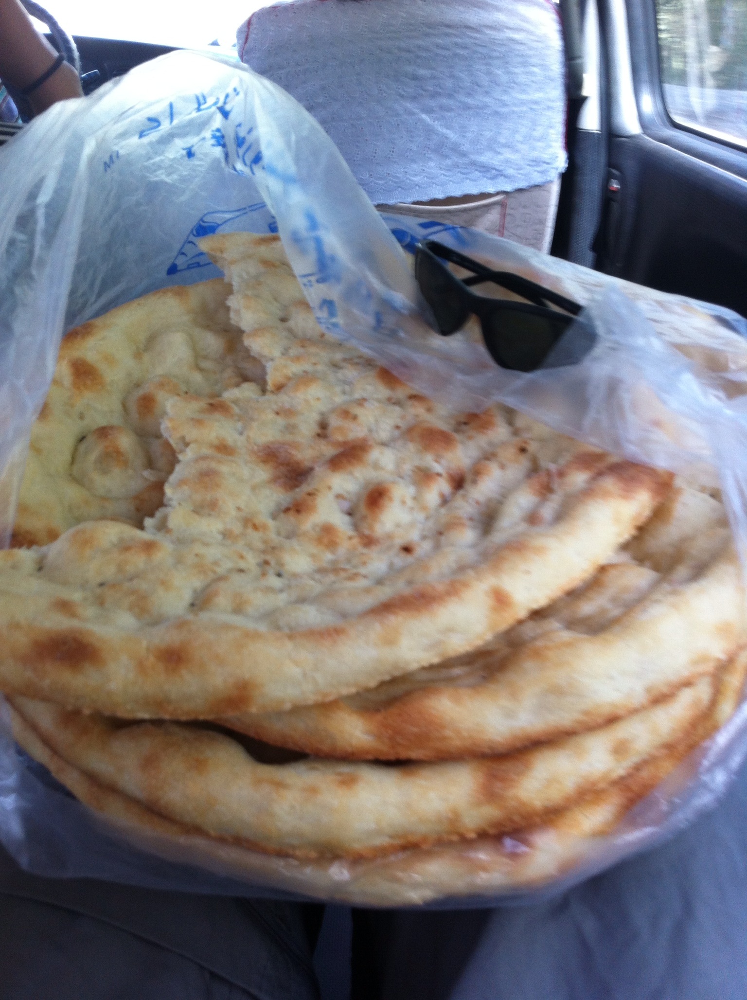
At Artush we stop to buy some massive Kyrgyz bread – like Uyghur but about twice the diameter. The mountains then shortly come into view. The irregularity in heights of the peaks and each peak’s individual steepness means it barely looks like a traditional range. Kashgar itself sits at around 1300m but we drive to around 2700m before clambering out, around 75-80 km northwest of Kashgar and just by the Kyrgyz border.

By this stage we have left the highway and headed directly into the hills but the signs of widespread knowledge of the site now are abundant. For starters, it is signposted; and this signage indicates its relatively Chinese name – Heaven’s Gate – about as original as calling an English pub the Red Lion. In Uyghur it is known as “Pierced Rock”.

Then at the end of the hill road, we come across a large carpark in the throes of completion, and matching visitor centre. Signs have also been erected indicating that tickets need to be bought but apparently this will not come into effect until next year when the facilities are completed. There are no tour buses as yet but presumably there will soon be a gondola or one of those golf kart trains to take people up to the arch itself.

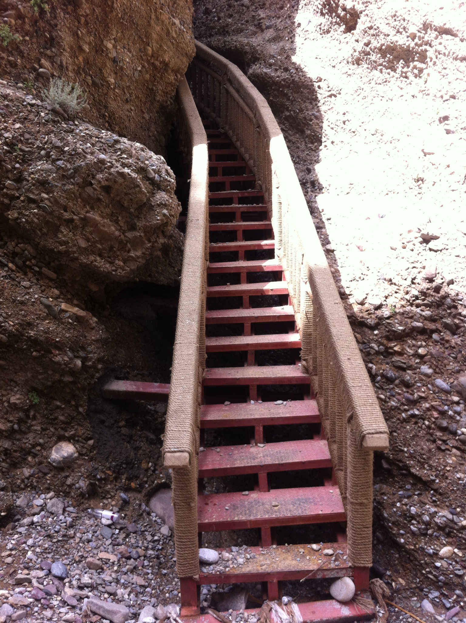
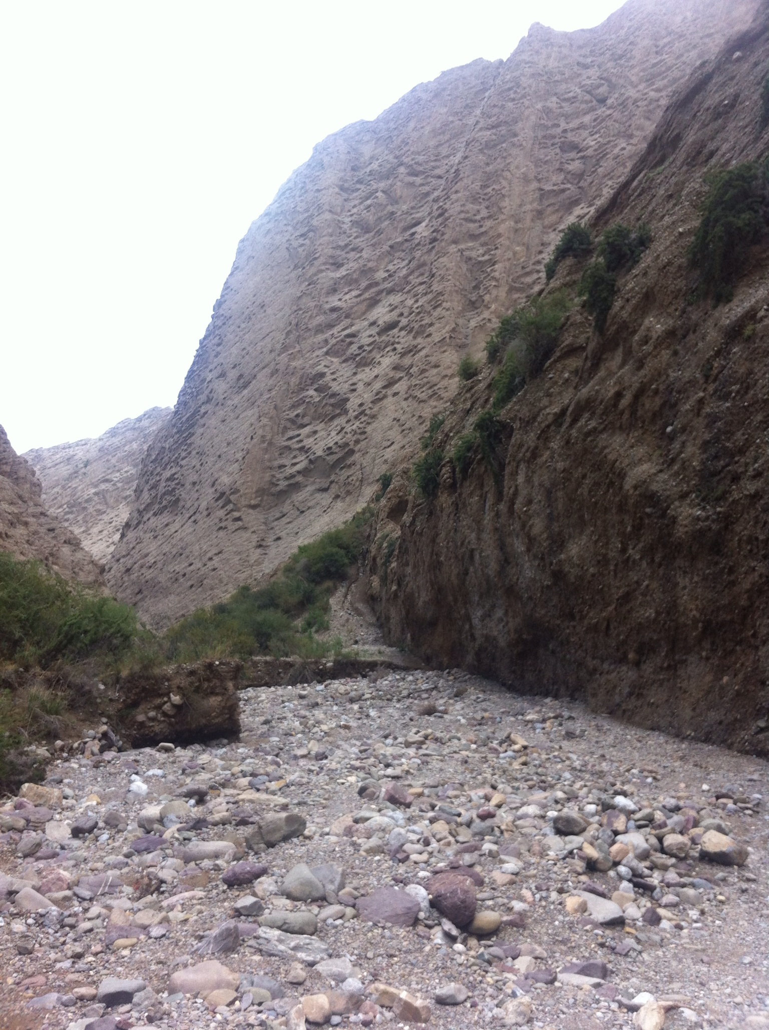
As it is now, there is a walk of about an hour up to view it, winding up what looks like an old glacier or river canyon – rocky underfoot such as is found along braided rivers and steeply eroded on both sides. There are semi-permanent metal steps in place in the tightest spots, where once there used to be bamboo ladders, and the climb is safe and fairly obvious even if unmarked.

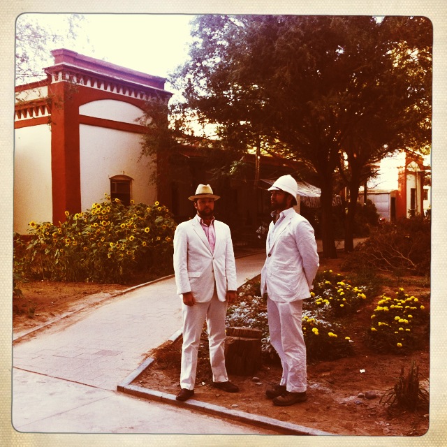
There is one group from Gansu undertaking it in traditional Chinese city wear of black slacks, short sleeve shirts and loafers but having slightly more appropriate footwear would probably have been an advantage to them (as it is they omit to take water and have to call down to their driver to bring some up to them at the top of the climb). They love the pith helmets though, so all judgement is withheld.

After about 40 mins the arch first comes into view. The canyon narrows and then rises to a steep back wall and the arch sits at the top of this. It looks large from a distance, but it is only the top 200 feet or so that can be seen from this angle as the slope up to it blocks the actual full drop of the arch it is sort of like the arch sits against a separate hill that then slopes down to form the canyon that we are in. Approaching from the other side to see the full extent is apparently very difficult and takes a great deal of mountaineering or canyoning expertise – after one has even found the right access point and route.

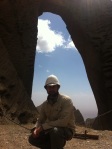
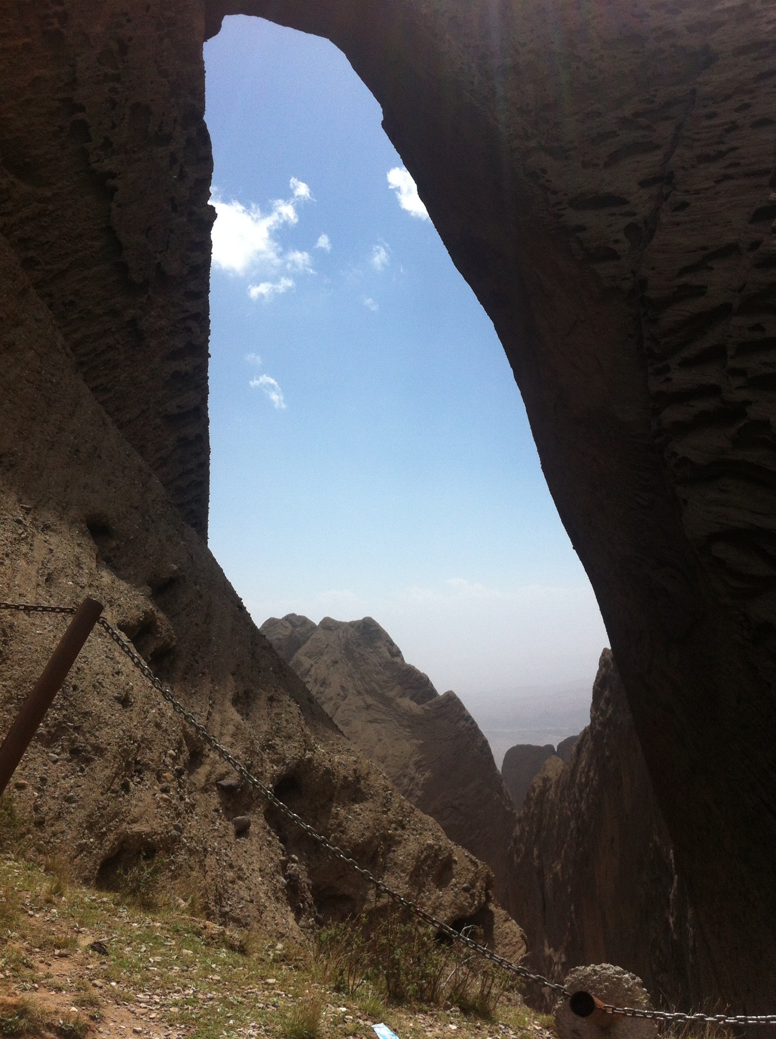
Climbing the final steep grass bank to sit under the arch gives you a much better feeling for its size. The grassy slope deteriorates into loose gravel and then banks down towards the sides of the arch. the slope of this bank restricts views to the bottom but what can be seen is dizzying, especially if one looks swiftly up then back again. There is a highly unworthy looking safety chain that has indeed been pulled out of the ground at one point.

Through the arch, off to the right can be seen in the far distance the town of Kashgar – obscured in the haze of heat and dust.

The pictures, as so often, barely do it justice. For starters, it is impossible to get the top of the arch and any decent quantity of what can be seen of the drop into the one shot.

It is however a great pleasure to be standing up here, above Kashgar, more or less on our own.

For what it is worth based on an IPhone compass (backed up by Casio at least as to altitude) we are:

– At 2940m
– The arch piercing is directly NW to SE i.e. we look SE back towards Kashgar – Co-ordinates of 39.6603 N; 75.5234 E

Couple of Kashgar mysteries

Lady Macartney made descriptions of the limited European presence in Kashgar at the time.

From Chini Bagh “below us ran a road… Beyond the road were fields of melon, rice, cotton and clover… In the midst of the fields was a sad little triangular bit of ground enclosed by a mud wall, and in it were a few mounds of earth, and Russian crosses. It was the Russian cemetery. Beyond it I could see the Kashgar river…”

This was where all Europeans who died in Kashgar were buried including missionaries, such as the Dutch Catholic Father Hendricks, who was George Macartney’s flatmate pre-marriage, and later source of information in relation to goins-on in and around the old town.

It presumably also included officers, diplomats, merchants and families and others who had the misfortune to die in what was then perhaps one of the world’s least visited locations.

The consulate still looks towards the river but the fields are now apartment blocks and houses and sadly asking a number of guides did not reveal anyone who knew anything about a European or Russian cemetery. Destruction of cemeteries was one aspect of the cultural revolution but it could quite easily have just been overtaken by growth and a pragmatic attitude to a series of alien monuments.

One way to find it might be to go back to old maps of Kashgar, pinpoint the exact position in relation to Chini Bagh and then retrace steps to it. Sadly old anything in Kashgar is difficult to find and the only bookshops are the small handful near the Id Kah mosque. So this will take more work.

More satisfactory was a walk from the old British to the old Russian consulate. It sits on a big intersection, across the road one way is a school and across another way is a restaurant named Sultana. On the walk from the China Bagh to the Russians you can see the remains of the city walls (a small section, by the PLA compound and hence awkward to photograph). Further along, just before the main intersection with the Russian consulate there is a small alleyway about a car wide. Modern buildings on the main street block it from view but you can just see a white pedimented building down this alleyway. It turns out to be very substantial.

All one storey classically laid out, colonnaded on the two long sides and with pediments on the shorter sides. It turns out to be Kashgar’s first “privately founded public kindergarten” and the entrance portico’s pillars have been brightly painted as a result. A teacher spoken to says it has been a kindergarten for around 12 years and thinks the building may have been connected “to the Soviets” before then. It certainly sits close enough to the old Russian (later Soviet) consulate to have perhaps been some sort of ancillary building – the consular residence perhaps, or barracks?

Lady Macartney said that in her time there were only four European buildings outside the old city walls – the two consulates, the Swedish mission and the Russo-Asiatic bank. The latter would presumably have been close to the Russian consulate. It was liquidated in 1925 or 26 but the building could conceivably date from before this time. There is a Soviet star above the main entrance but this could have been a later addition and while the building is large it does not seem to be quite as monolithic as the classic Stalinesque structure. Again, a map of Kashgar from the 1920s or so, if such a thing exists, would help to clear this up. This is an exercise that might take some time.

Chini Bagh – the British consulate at Kashgar

In 1890 Sir Francis Younghusband (who was to lead Britain’s campaign to extend its influence to Tibet in 1904) led an expedition to Kashgar and the Pamirs, for which George Macartney. Macartney was the son of a Scottish knight and a Chinese mother and was 24 in 1890. He married Catherine Borland in 1898, and she went on to write “An English Lady in Chinese Turkestan”, which is a memoir well known to anyone with an interest in Kashgaria but equally obscure to anyone else.

When Younghusband returned to India in 1891, Macartney was told to remain as representative of British interests in the area – which officially was concerned with the rights and treatment of the many traders who would travel over the passes from British India and make their base in Yarkand or Yensigar or Kashgar. Naturally of course there were broader interests, particularly given the weakening of the Qing dynasty and the parallel efforts of Russia to increase its influence in their shared borderlands, of which the province now known as Xinjiang formed a significant part.

From 1891 until 1908 Macartney’s position was one of Agent; with Russian pressure on Peking preventing formal recognition as a consulate. This changed with a 1907 Anglo-Russian treaty dealing with interests in Persia, Afghanistan and Tibet and in 1908, the Kashgar mission became a consulate. It was upgraded (and Macartney with it) to consulate-general in 1910 (or 1912 or 1914 – Lady Macartney references two dates, Peter Hopkirk a third).

The mission occupied the same premises from 1890 onwards. This was initially a local house that was demolished to make way for the new mission – which was built with two foot thick sun backed brick walls with crenallations for show. It was built on largely one storey due to the area’s frequent earthquakes; and a wooden verandah was added after Mrs Macartney returned with his wife (though the original version of this did fall down in an earthquake). The name given to it means Chinese Garden, apparently in Uyghur, though these words have a Persian derivation.

In Lady Macartney’s book there is an image of how the entrance to Chini Bagh looked as the consulate general, and this is reproduced below.

The house was famed for its gardens and its comforts provided respite to all well known travellers through Chinese Central Asia such as von Le Coq, Stein, Fleming and Maillart. Later consuls included Percy Sykes, Clarmont Skrine and Eric Shipton – all of whom left written memories of Kashgaria.

The gardens would have sat in between the gatehouse (which forms the first line of building that can be seen in the photo above) and the house itself; whose single room of second storey can be seen above the wall and its wooden verandah seen through the gate itself. It sat on a high cliff looking towards what was then the Kashgar river.

Amazingly today, the house remains. The gatehouse and wall have gone but the main house is there – with its recognisable facade and its single block of double storey – albeit totally overshadowed by what is now the vast complex of a hotel that takes its name from the original, the Qi Ni Wa Ke (.

The consulate can be found by walking down an alleyway between two of the larger hotel buildings. It is suitably dilapidated and has the remnants of a dusty garden around it but is at least painted sympathetically in whitewash with red edgings. Even a wobbly verandah remains.

The building is now owned by the local Cultural Relics Bureau – who have also developed the monstrous hotel out the front – somewhat in conflict to what might be a traditional interpretation of their core task of heritage preservation. Presumably profits from the hotel support even greater heritage work elsewhere…

Sadly the area around Chini Bagh, sitting as it does out of sight of the hotel’s forecourt, seems to operate as a general disposal or holding area with bits of metal, piles of rubbish and general detritus adding some colour to the garden. The bay window of what feels like it must have been one of the major entertaining rooms does still look over an escarpment but from the bottom of this rise rickety flats so the view is somewhat compromised.

Kashgar’s cultural relics bureau has provided a few informative signs but the information is a little inaccurate in places (e.g. confusing first and second world wars) and highly idiosyncratic in others. What did happen was that after Indian-Pakistani partition the consulate became a joint Indo-Pak one and then in 1953, according to a Chinese sign, it appears to have been taken over by the government and become an entertainment facility for Kashgar resident diplomatic community – which must have been minuscule (and only Soviet?) given the Indo-Pak consulate had just been requisitioned and westerners were basically banned from the region until around 1985-86. Perhaps it was this act of nationalisation that actually saved it.

Chini Bagh is currently leased out to operators of a Chinese restaurant with drinks at prices that imply it only ever serves people who have travelled a long way to get here, with inelasticity to match. It wasn’t entirely clear whether the food was worth the journey either. The incumbents have been running it for seven or eight years. They have installed elaborate Russian style carved panelling that in style, tone and even colour is a direct replica of the decorative work still visible at the old Russian consulate, now also an hotel, across town). One or two ‘original’ rooms remain and the restaurateur points out the floorboards and ceilings as being unaltered – but it appears that 70 years after Chini Bagh’s closure as a British listening post, the Russians have taken over.

Chini Bagh is one of the few addresses that everyone in Kashgar knows so it is easy enough to find and seems to be little visited – though a few small Chinese tour groups do show up while we are there to see the old consulate.

Fighting for history in Kashgar

Two chaps looking for Empire; at the remains of (never the) Chini Bagh, Kashgar.

Gallery

Images of Kashgar’s new old town

This gallery contains 8 photos.

Yarkand to Kashgar

Yarkand’s bus station is one place that has not changed though it is much busier than nine years ago. Chaos also reigns – the formality of the new towns of Qiemo and Ruoqiang has broken down by here and there are rucks around all ticket windows and all manner of men and vehicles touting for business in competition with the buses as we walk in. In all ways, just like thousands of other out of the way, long distance bus stops. The obviously Han Chinese travellers get a much firmer sell from the minicabbers than anyone else.

There are at least 60 buses parked outside, mirror to mirror. It implies a very organised parking and dispatch system but the reality seems to be more like an ultra complicated version of one of those children’s puzzles, where there is one empty square and you move all the other squares around in order to reach the target pattern. The drivers appear very dexterous, undertaking the impossible task of moving their huge vehicles through tiny gaps.

Next to the station is the inevitable Transport Hotel. When passing through in 2004 I attempted to get a room here to be asked, firstly, whether I was Malaysian and on answering negatively, to see my passport. They then said I could not stay and could in fact only stay at the Shache Hotel. I have often wondered whether being Malaysian might have offered greater privileges or whether it was just a country they knew of, far away, that had a Moslem population and hence might conceivably be the source of funny looking visitors in these parts.

Thankfully the trip is only 170km and is completed, along this endless clean and largely empty highway, in three hours. The clever coded seating on the Chinese tickets also having been generally abandoned by the local community.

It is only on leaving Yarkand that it becomes clear who is moving into all these large tower blocks being built all over town, as in all the other oases through which we have passed. Large outlying sections of traditional housing have been razed and the inhabitants presumably moved. In this there is no difference with Beijing or any other Chinese town – though the motivation is probably less property development than creating something more systematic and easy to administer.

Entering into Kashgar starts to give a feel of the massive changes that have taken place here – no different to anywhere else, but better publicised. Vast arrays of new housing developments greet arrivals by car – some in mock Qing style others just in the bland modern vernacular of every city in China. The town has certainly spread and is a cluster of high rises now. Bits of old town exist but they are pocketed well out of town, for instance to the north beyond “Welcome Guest Avenue” (欢宾大道). The centre of town is where the destruction has most famously occurred – and again the comparison with the loss of the Hutongs in Beijing is an easy one. The replacement has, to the credit of the authorities, nowhere near as bad as it could be, but it is basically a Silk Road disneyland. Roads have been paved and widened and faced with fret-worked, khaki coloured low rises that might be sympathetic but en masse, having replaced the real thing, still seem to be a waste.

This all started some years ago – initially clearing a plaza in front of the Id Kah mosque and then working outwards. Nine years ago this had not breached Liberation Rd, running perpendicular to the mosque, but now there stand large shopping malls in similar islamic pastiche. The view of locals was that the authorities were not keen on sandy roads that were impassable at speed by vehicles and the creation of new roads through traditional areas seems to bear this out.

The “new” old town (described as 1000 year old street now) is still a nice enough place to walk around and no doubt the magic of Chinese construction will mean the buildings will look old well ahead of their time. Signs give directions in English, Chinese, Uyghur and also Russian. It will no doubt be a tourism hit and seems to already be attracting out of town Uyghurs (who are much more impressed by the presence of foreigners). There is at least one very nice restaurant, hidden behind trees and off the main pedestrian paths, that is populated solely by Uyghur men and does not offer Chinese food. It is a restful and cool place for noodles and nan.

Looming over the whole in the distance is a vast yellow tower whose red signage proclaims it to be the China Bagh Hotel – i.e. the hotel on the grounds of the old British Consulate. This too is new of course (though the consular grounds had long been ruined by other smaller edifices) but its size and apparent vanity, is at least as much of a surprise as any of the other more expected changes.

It is interesting to see some Pakistanis on the street too; heavily bearded and in shalweer kameez. There had been one or two in Yarkand but they lend credence to the continuing claims of Kashgar as a trading entrepôt.

The old kingdom of Yarkand

It was a relief to finally be able to leave Khotan and make our way to Yarkand. The recently ropey road that went east of Kashgar, linking the towns we are no passing through, is now a lightly used motorway. Its mere existence is something of a triumph over the desert. All the way along since we hit Ruoqiang and the start of where the 315 meets the southern ridge of the Taklamakan Desert, you can see the attempts to hold it back with gridded plantings of poplars (at least locally authentic) and what looks like just dried straw, spread around 30m each way astride the road.

The best place to go and see in Yarkand is the tomb of their historic kings from the 16th and 17th century. It is calm and cool, carapaced by large spreading trees and surrounded by high white walls. It adjoins the mosque and the newly created “Culture Square”. The mosque is very Bukhara-style, with its mud brick walls and delicately pillared colonnades – but it is time of evening prayer and it does not anyway seem to be open to non-believers. Instead we sort of potter round the edges. The tomb complex is rather splendid but looks heavily made-up – some more authentic looking tombs in crumbling mud brick indicate how it must have looked pre its restoration and addition of a fancy pavilion.

Our tickets also show they give access to the “Kings’ Palace”. This explains what is happening across the road, where a massive section of the old city has been razed and from it has now arisen a crenellated concrete edifice about 120m square, with small moorish windows. It looks like an unpainted version of the Doge’s Palace. In time it will be covered in dun coloured plaster and have red and white umbrellas scattered through its large internal courtyard and along its battlements where the imminent hordes of thirsty tourists will be refreshed.

The tourists are yet to arrive in real numbers however. It seems Xinjiang’s now widespread reputation for violence (at least in the southern part if not so much Urumqi and points north) has meant that Han Chinese have stayed away more so than they have for say, Lhasa.

Yarkand is a much smaller town than Hetian but also has a proportionately less prominent Chinese presence. It does not have the militarised feeling of Hetian (nor does it have the long history of anti-Chinese violence that Hetian does – e.g. its massacre of a Chinese garrison to which it granted safe passage, shortly before Peter Fleming’s arrival in the city in the early 1930s) but it still feels like a Uyghur town rather than an occupied town. Its streets are largely unrecognisable from nine years ago but it is a small place with a very limited Han presence. It is actually a lot nicer place to spend time and to wander around.

The old town in particular has survived in parts and walking around it, or any old town (of which there are few now) is one of Xinjiang’s main attractions. Khaki houses broken by wooden lintels form semi-straight lines along sand or mud lanes through which many more playing children pass than cars. Schools get out at 7pm Beijing time (5pm local time) and so an evening stroll is a lively one.

A group of older chaps do not seem that impressed (in almost unrecognisably accented Mandarin) by the destruction that has reduced the traditional town’s size dramatically in favour of Chinese style apartment blocks; nor are they by the dress code of Chinese visitors (nor, even, by beards it seems). They have, for now, a lot more to remind them of their real way of living than their counterparts in other towns, and it makes it is a great place to be a flaneur.